


gileppe Barak Michel_backup

ameurant
Gebruiker
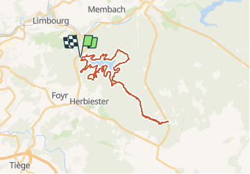

Lengte
31 km

Max. hoogte
517 m

Positief hoogteverschil
633 m
Km-Effort
39 km

Min. hoogte
292 m

Negatief hoogteverschil
634 m
Boucle
Ja
Datum van aanmaak :
2016-09-10 00:00:00.0
Laatste wijziging :
2016-09-10 00:00:00.0
7h01
Moeilijkheid : Medium

Gratisgps-wandelapplicatie
 SityTrail
IGN / Geografische instituten
SityTrail Plus
De wereld gaat voor u open
Over ons
Tocht Stappen van 31 km beschikbaar op Wallonië, Luik, Jalhay. Deze tocht wordt voorgesteld door ameurant.
Beschrijving
gileppe Barak Michel_backup
Plaatsbepaling
Land:
Belgium
Regio :
Wallonië
Departement/Provincie :
Luik
Gemeente :
Jalhay
Locatie:
Jalhay
Vertrek:(Dec)
Vertrek:(UTM)
710255 ; 5608296 (31U) N.
Opmerkingen