


Mont St Quentin

PhilippeC54
Gebruiker

Lengte
69 km

Max. hoogte
338 m

Positief hoogteverschil
577 m
Km-Effort
76 km

Min. hoogte
161 m

Negatief hoogteverschil
582 m
Boucle
Neen
Datum van aanmaak :
2019-05-07 11:29:02.173
Laatste wijziging :
2019-05-07 15:27:44.962
3h27
Moeilijkheid : Gemakkelijk

Gratisgps-wandelapplicatie
 SityTrail
IGN / Geografische instituten
SityTrail Plus
De wereld gaat voor u open
Over ons
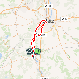
Tocht Wegfiets van 69 km beschikbaar op Grand Est, Meurthe-et-Moselle, Pont-à-Mousson. Deze tocht wordt voorgesteld door PhilippeC54.
Plaatsbepaling
Land:
France
Regio :
Grand Est
Departement/Provincie :
Meurthe-et-Moselle
Gemeente :
Pont-à-Mousson
Locatie:
Unknown
Vertrek:(Dec)
Vertrek:(UTM)
283366 ; 5420570 (32U) N.
Opmerkingen