


BOUILLOUSES CAMPORELLS

UDGI54
Gebruiker
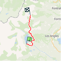

Lengte
11,7 km

Max. hoogte
2251 m

Positief hoogteverschil
530 m
Km-Effort
18 km

Min. hoogte
1940 m

Negatief hoogteverschil
303 m
Boucle
Neen
Datum van aanmaak :
2019-05-27 07:55:36.862
Laatste wijziging :
2019-05-27 07:57:00.455
3h51
Moeilijkheid : Moeilijk

Gratisgps-wandelapplicatie
 SityTrail
IGN / Geografische instituten
SityTrail Plus
De wereld gaat voor u open
Over ons
Tocht Stappen van 11,7 km beschikbaar op Occitanië, Pyrénées-Orientales, Angoustrine-Villeneuve-des-Escaldes. Deze tocht wordt voorgesteld door UDGI54.
Plaatsbepaling
Land:
France
Regio :
Occitanië
Departement/Provincie :
Pyrénées-Orientales
Gemeente :
Angoustrine-Villeneuve-des-Escaldes
Locatie:
Unknown
Vertrek:(Dec)
Vertrek:(UTM)
417804 ; 4712407 (31T) N.
Opmerkingen