


Étang Planes

Merlos
Gebruiker

Lengte
11,4 km
Boucle
Ja
Datum van aanmaak :
2019-05-31 09:44:09.858
Laatste wijziging :
2019-05-31 15:50:06.06
4h38
Moeilijkheid : Gemakkelijk

Gratisgps-wandelapplicatie
 SityTrail
IGN / Geografische instituten
SityTrail Plus
De wereld gaat voor u open
Over ons
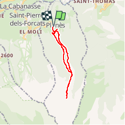
Tocht Stappen van 11,4 km beschikbaar op Occitanië, Pyrénées-Orientales, Planès. Deze tocht wordt voorgesteld door Merlos.
Beschrijving
très belle rando rafraîchissante (ruisseau, étang) la montée est à l'ombre ce qui n'est pas négligeable quand il fait chaud...
Foto's


Plaatsbepaling
Land:
France
Regio :
Occitanië
Departement/Provincie :
Pyrénées-Orientales
Gemeente :
Planès
Locatie:
Unknown
Vertrek:(Dec)
Vertrek:(UTM)
429213 ; 4704648 (31T) N.
Opmerkingen