


Randonnée de la Bastide Puylaurens à la Garde Guérin

ajasse
Gebruiker

Lengte
20 km

Max. hoogte
1141 m

Positief hoogteverschil
443 m
Km-Effort
26 km

Min. hoogte
800 m

Negatief hoogteverschil
598 m
Boucle
Neen
Datum van aanmaak :
2019-06-03 08:00:45.229
Laatste wijziging :
2019-06-04 08:51:11.296
6h19
Moeilijkheid : Moeilijk

Gratisgps-wandelapplicatie
 SityTrail
IGN / Geografische instituten
SityTrail Plus
De wereld gaat voor u open
Over ons
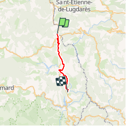
Tocht Stappen van 20 km beschikbaar op Occitanië, Lozère, La Bastide-Puylaurent. Deze tocht wordt voorgesteld door ajasse.
Beschrijving
départ de la Gare de la Bastide Puylaurent en direction de la Garde Guérin.
Petit détour par Prevencheres.
Ne pas manquer le belvédère à la Garde Guérin ainsi que l'a visite du village.
Foto's

Plaatsbepaling
Land:
France
Regio :
Occitanië
Departement/Provincie :
Lozère
Gemeente :
La Bastide-Puylaurent
Locatie:
Unknown
Vertrek:(Dec)
Vertrek:(UTM)
571784 ; 4938198 (31T) N.
Opmerkingen