


Le Mas de la barque

ajasse
Gebruiker

Lengte
16,7 km
Boucle
Ja
Datum van aanmaak :
2019-06-04 07:35:14.168
Laatste wijziging :
2019-06-04 19:28:35.056
5h26
Moeilijkheid : Medium

Gratisgps-wandelapplicatie
 SityTrail
IGN / Geografische instituten
SityTrail Plus
De wereld gaat voor u open
Over ons
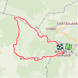
Tocht Stappen van 16,7 km beschikbaar op Occitanië, Lozère, Vialas. Deze tocht wordt voorgesteld door ajasse.
Beschrijving
Départ du mas de la barque
Pic Cassini / source du Tarn/ Pont de Camargues/ Bellecoste
très belle randonnée
Foto's


Plaatsbepaling
Land:
France
Regio :
Occitanië
Departement/Provincie :
Lozère
Gemeente :
Vialas
Locatie:
Unknown
Vertrek:(Dec)
Vertrek:(UTM)
569751 ; 4915099 (31T) N.
Opmerkingen