


Bec d’andaine - pointe du grouin sud

eric.deniau
Gebruiker

Lengte
14,1 km
Boucle
Ja
Datum van aanmaak :
2019-07-14 07:36:32.0
Laatste wijziging :
2019-07-14 11:55:05.926
3h32
Moeilijkheid : Onbekend

Gratisgps-wandelapplicatie
 SityTrail
IGN / Geografische instituten
SityTrail Plus
De wereld gaat voor u open
Over ons
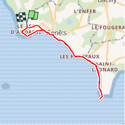
Tocht Stappen van 14,1 km beschikbaar op Normandië, Manche, Genêts. Deze tocht wordt voorgesteld door eric.deniau.
Plaatsbepaling
Land:
France
Regio :
Normandië
Departement/Provincie :
Manche
Gemeente :
Genêts
Locatie:
Unknown
Vertrek:(Dec)
Vertrek:(UTM)
610541 ; 5393902 (30U) N.
Opmerkingen