


Balade en Val de Lesse - De Hour à Wanlin

Desrumaux
Gebruiker GUIDE
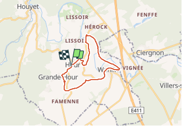

Lengte
10,7 km

Max. hoogte
215 m

Positief hoogteverschil
176 m
Km-Effort
13,1 km

Min. hoogte
124 m

Negatief hoogteverschil
180 m
Boucle
Ja
Datum van aanmaak :
2019-08-19 08:13:53.443
Laatste wijziging :
2023-10-14 07:13:40.431
2h58
Moeilijkheid : Moeilijk

Gratisgps-wandelapplicatie
 SityTrail
IGN / Geografische instituten
SityTrail Plus
De wereld gaat voor u open
Over ons
Tocht Stappen van 10,7 km beschikbaar op Wallonië, Namen, Houyet. Deze tocht wordt voorgesteld door Desrumaux.
Beschrijving
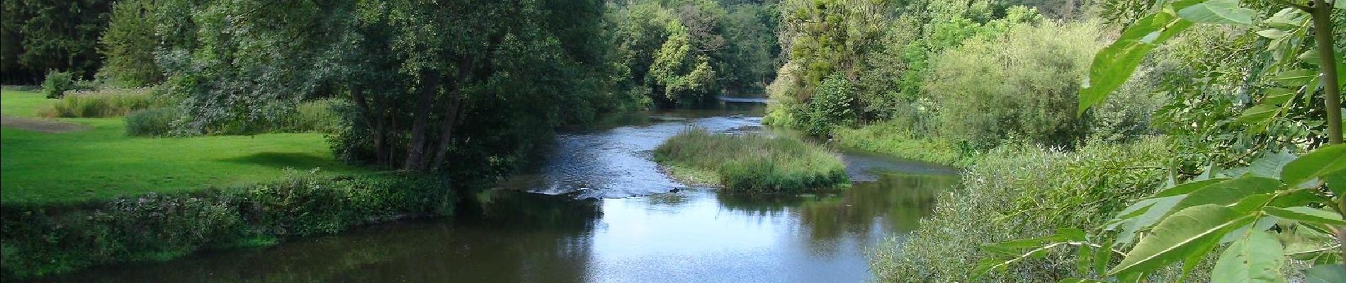
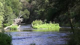
Jolie balade en val de Lesse
Foto's


Plaatsbepaling
Land:
Belgium
Regio :
Wallonië
Departement/Provincie :
Namen
Gemeente :
Houyet
Locatie:
Unknown
Vertrek:(Dec)
Vertrek:(UTM)
645453 ; 5558528 (31U) N.
Opmerkingen