Tocht Mountainbike Saint-Nicolas-de-Bourgueil - 
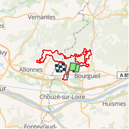
Zevtt - Bourgueil 65 km - Photo
 kipoura
kipoura

Gebruiker

© OpenStreetMap contributors
Lengte
Lengte
65 km
Max. hoogte
Max. hoogte
125 m
Positief hoogteverschil
1111 m
Km-Effort
Km-Effort  
79 km
Min. hoogte
Min. hoogte
24 m
Negatief hoogteverschil
1108 m
Boucle
Boucle
Ja
Datum van aanmaak :
2019-05-03 17:10:11.784
Laatste wijziging :
2019-05-03 17:10:12.275

(0 Bericht)

Mountainbike
Mountainbike
5h03
Moeilijkheid : Moeilijk

Scan deze QR-code om de tocht te openen in de SityTrail-applicatie

Gratisgps-wandelapplicatie

Logo SityTrail SityTrail

IGN / Geografische instituten

SityTrail uit de App Store downloaden SityTrail uit Google Play downloaden

Logo SityTrail SityTrail Plus

De wereld gaat voor u open

SityTrail uit de App Store downloaden SityTrail uit Google Play downloaden SityTrail op Huawei AppGallery downloaden

Over ons

Tocht Mountainbike van 65 km beschikbaar op Centre-Val de Loire, Indre-et-Loire, Saint-Nicolas-de-Bourgueil. Deze tocht wordt voorgesteld door kipoura.

Beschrijving

Attention là c'est du lourd. Un circuit VTT au départ de St Nicolas de Bourgueil, passage par les vignes et direction les bois, pour un parcours très ludique et physique. De superbes passages techniques, énormément de relance et de gros raidards à gravir. Condition physique au top pour apprécier à sa juste valeur ce tracé. http://zevtt.free.fr

Hoogteprofiel

Plaatsbepaling

Land:
France
Regio :
Centre-Val de Loire
Departement/Provincie :
Indre-et-Loire
Gemeente :
Saint-Nicolas-de-Bourgueil
Locatie:
Unknown
Vertrek:(Dec)
Vertrek:(UTM)
282555 ; 5239905 (31T) N.


Sluiten
Mijn abonnementen