


Balade dans le Viroinval - Le Mesnil

Desrumaux
Gebruiker GUIDE
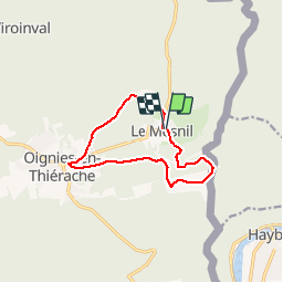

Lengte
9,7 km

Max. hoogte
372 m

Positief hoogteverschil
203 m
Km-Effort
12,5 km

Min. hoogte
270 m

Negatief hoogteverschil
206 m
Boucle
Ja
Datum van aanmaak :
2019-11-30 09:12:41.359
Laatste wijziging :
2019-12-03 06:45:46.29
3h36
Moeilijkheid : Heel gemakkelijk

Gratisgps-wandelapplicatie
 SityTrail
IGN / Geografische instituten
SityTrail Plus
De wereld gaat voor u open
Over ons
Tocht Stappen van 9,7 km beschikbaar op Wallonië, Namen, Viroinval. Deze tocht wordt voorgesteld door Desrumaux.
Beschrijving
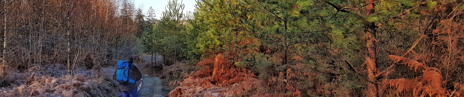
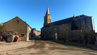
Village clairière enclavé dans la grande forêt ardennaise, Le Mesnil est le village le moins peuplé et le plus pittoresque de l'entité de Viroinval.
Balisage: rectangle rouge
Foto's


Plaatsbepaling
Land:
Belgium
Regio :
Wallonië
Departement/Provincie :
Namen
Gemeente :
Viroinval
Locatie:
Le Mesnil
Vertrek:(Dec)
Vertrek:(UTM)
619766 ; 5543450 (31U) N.
Opmerkingen