


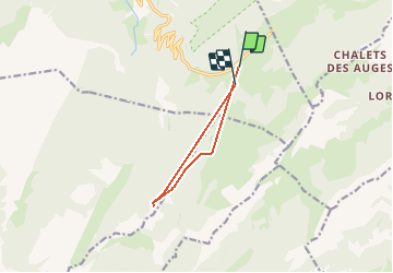
Tête Noir depuis le plateau des Glières

sebastienu
Gebruiker

Lengte
7,9 km

Max. hoogte
1806 m

Positief hoogteverschil
480 m
Km-Effort
14,4 km

Min. hoogte
1379 m

Negatief hoogteverschil
502 m
Boucle
Neen
Datum van aanmaak :
2020-01-01 09:59:19.813
Laatste wijziging :
2020-01-01 15:45:21.625
5h44
Moeilijkheid : Medium

Gratisgps-wandelapplicatie
 SityTrail
IGN / Geografische instituten
SityTrail Plus
De wereld gaat voor u open
Over ons
Tocht Sneeuwschoenen van 7,9 km beschikbaar op Auvergne-Rhône-Alpes, Haute-Savoie, Fillière. Deze tocht wordt voorgesteld door sebastienu.
Plaatsbepaling
Land:
France
Regio :
Auvergne-Rhône-Alpes
Departement/Provincie :
Haute-Savoie
Gemeente :
Fillière
Locatie:
Thorens-Glières
Vertrek:(Dec)
Vertrek:(UTM)
292436 ; 5092933 (32T) N.
Opmerkingen