


Chassin a/r 12 01 2020

RenaudCandottiBesson
Gebruiker
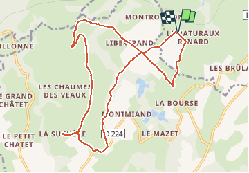

Lengte
10,9 km

Max. hoogte
563 m

Positief hoogteverschil
264 m
Km-Effort
14,4 km

Min. hoogte
399 m

Negatief hoogteverschil
263 m
Boucle
Ja
Datum van aanmaak :
2020-01-12 13:05:07.618
Laatste wijziging :
2020-01-12 16:48:31.72
2h46
Moeilijkheid : Heel gemakkelijk

Gratisgps-wandelapplicatie
 SityTrail
IGN / Geografische instituten
SityTrail Plus
De wereld gaat voor u open
Over ons
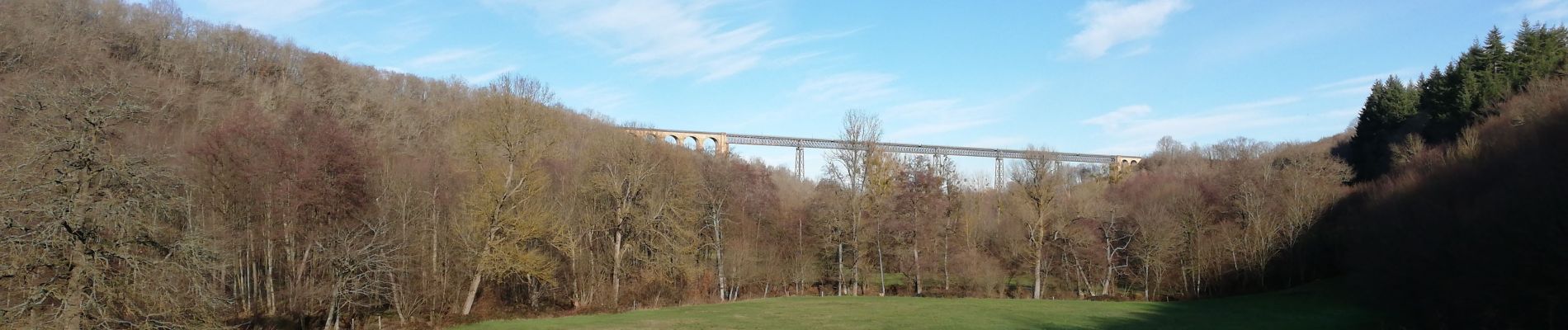
Tocht Stappen van 10,9 km beschikbaar op Auvergne-Rhône-Alpes, Allier, Louroux-de-Bouble. Deze tocht wordt voorgesteld door RenaudCandottiBesson.
Foto's

Plaatsbepaling
Land:
France
Regio :
Auvergne-Rhône-Alpes
Departement/Provincie :
Allier
Gemeente :
Louroux-de-Bouble
Locatie:
Unknown
Vertrek:(Dec)
Vertrek:(UTM)
496940 ; 5118270 (31T) N.
Opmerkingen