Tocht Stappen The Municipal District of Cahir — Cashel - Carroll''s Loop - Photo
 mlmoroneybb
mlmoroneybb

Gebruiker

© OpenStreetMap contributors
Lengte
Lengte
4,5 km
Max. hoogte
Max. hoogte
191 m
Positief hoogteverschil
104 m
Km-Effort
Km-Effort  
5,9 km
Min. hoogte
Min. hoogte
101 m
Negatief hoogteverschil
100 m
Boucle
Boucle
Ja
Datum van aanmaak :
2014-12-11 00:00:00.0
Laatste wijziging :
2014-12-11 00:00:00.0

(0 Bericht)

Stappen
Stappen
1h18
Moeilijkheid : Onbekend

Scan deze QR-code om de tocht te openen in de SityTrail-applicatie

Gratisgps-wandelapplicatie

Logo SityTrail SityTrail

IGN / Geografische instituten

SityTrail uit de App Store downloaden SityTrail uit Google Play downloaden

Logo SityTrail SityTrail Plus

De wereld gaat voor u open

SityTrail uit de App Store downloaden SityTrail uit Google Play downloaden SityTrail op Huawei AppGallery downloaden

Over ons

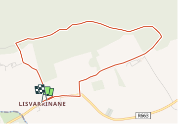
Tocht Stappen van 4,5 km beschikbaar op Onbekend, County Tipperary, The Municipal District of Cahir — Cashel. Deze tocht wordt voorgesteld door mlmoroneybb.

Beschrijving

When William Bulfin, author of Rambles of Eireann, arrived at the top of Slievenamuck and looked down on Lisvarrinane he was completely captivated by what he saw and wrote ??the brightness and freshness of its beauty are entrancing? Those green, swelling, smiling fields, that silver stream, the heather clad slopes of the Galtees, and the thick woods along the northern hills are glorious?

Hoogteprofiel

Plaatsbepaling

Land:
Ireland
Regio :
Onbekend
Departement/Provincie :
County Tipperary
Gemeente :
The Municipal District of Cahir — Cashel
Locatie:
Clonbeg
Vertrek:(Dec)
Vertrek:(UTM)
552549 ; 5807117 (29U) N.


Sluiten
Mijn abonnementen