


GR10 Sare - Col de Veaux

winkelmuller
Gebruiker
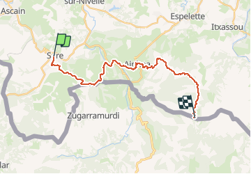

Lengte
24 km
Boucle
Neen
Datum van aanmaak :
2020-06-16 06:32:53.398
Laatste wijziging :
2020-06-16 15:46:58.385
9h04
Moeilijkheid : Moeilijk

Gratisgps-wandelapplicatie
 SityTrail
IGN / Geografische instituten
SityTrail Plus
De wereld gaat voor u open
Over ons
Tocht Stappen van 24 km beschikbaar op Nieuw-Aquitanië, Pyrénées-Atlantiques, Sare. Deze tocht wordt voorgesteld door winkelmuller.
Plaatsbepaling
Land:
France
Regio :
Nieuw-Aquitanië
Departement/Provincie :
Pyrénées-Atlantiques
Gemeente :
Sare
Locatie:
Unknown
Vertrek:(Dec)
Vertrek:(UTM)
615130 ; 4796514 (30T) N.
Opmerkingen