Tocht Stappen Tautavel - Tautavel chemin des bacs - Photo
 jcmartin
jcmartin

Gebruiker

© OpenStreetMap contributors
Lengte
Lengte
9,5 km
Max. hoogte
Max. hoogte
227 m
Positief hoogteverschil
218 m
Km-Effort
Km-Effort  
12,4 km
Min. hoogte
Min. hoogte
95 m
Negatief hoogteverschil
218 m
Boucle
Boucle
Ja
Datum van aanmaak :
2020-06-23 08:32:38.121
Laatste wijziging :
2020-06-23 15:10:55.799

(3 Bericht)

Stappen
Stappen
2h30
Moeilijkheid : Gemakkelijk

Scan deze QR-code om de tocht te openen in de SityTrail-applicatie

Gratisgps-wandelapplicatie

Logo SityTrail SityTrail

IGN / Geografische instituten

SityTrail uit de App Store downloaden SityTrail uit Google Play downloaden

Logo SityTrail SityTrail World

De wereld gaat voor u open

SityTrail uit de App Store downloaden SityTrail uit Google Play downloaden SityTrail op Huawei AppGallery downloaden

Over ons

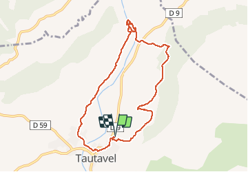
Tocht Stappen van 9,5 km beschikbaar op Occitanië, Pyrénées-Orientales, Tautavel. Deze tocht wordt voorgesteld door jcmartin.

Beschrijving

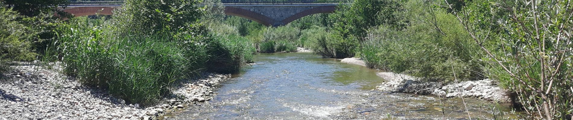
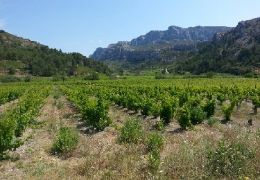
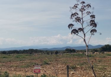
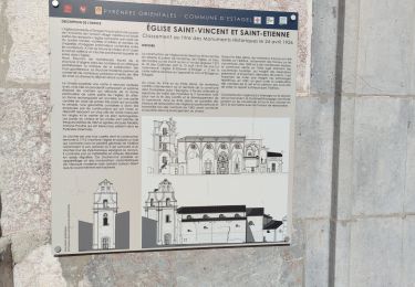
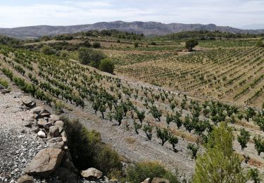
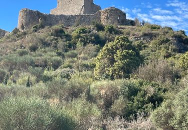
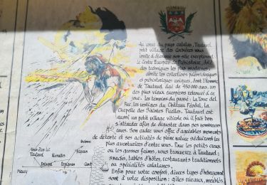
Sentier de randonnée balisé en jaune au départ de Tautavel qui longe le ruisseau du Verdouble jusqu'aux gorges de Gouleyrous qui sont surplombées par la Caune de l'Arago où ont été retrouvés des vestiges des hommes préhistoriques. La randonnée balisée fait 8,5Km et 200m de dénivelé, j'ai rajouté 1Km de plus en me promenant dans les Gorges

Hoogteprofiel

Foto's

Plaatsbepaling

Land:
France
Regio :
Occitanië
Departement/Provincie :
Pyrénées-Orientales
Gemeente :
Tautavel
Locatie:
Unknown
Vertrek:(UTM)
479613 ; 4740569 (31T) N.

Opmerkingen

Gelieve in te loggen om een commentaar of een beoordeling achter te laten


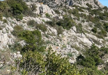
belle promenade à travers les pins et les vignes. Les gorges sont inaccessibles aux familles.


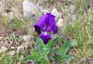
Très belle balade qui condence les plus beaux paysages de la région !


Wandeltochten in de omgeving

Tocht Stappen Vingrau - Chemin des Contrebandiers Vingrau variante - Photo
Stappen
force

Stappen

Medium
(2)
Vingrau, Occitanië, Pyrénées-Orientales, France
10,4 km | 16 km-effort
3h 30min
Ja
Tocht Stappen Vingrau - Vingrau - Photo
Stappen
GUIDE
Ada11

Stappen

Medium
Vingrau, Occitanië, Pyrénées-Orientales, France
15,5 km | 22 km-effort
4h 20min
Ja
Tocht Stappen Estagel - ESTAGEL Chapelle St Laurent MARDI FAIT - Photo
Stappen
MarcOBRECHT

Stappen

Medium
Estagel, Occitanië, Pyrénées-Orientales, France
12,2 km | 16,9 km-effort
3h 26min
Ja
Tocht Stappen Cases-de-Pène - 2023-08-01_12h04m36_SityTrail - 3754591 - cases-de-pene-x-detour-et-retour - Photo
Stappen
ehalle8544

Stappen

Medium
Cases-de-Pène, Occitanië, Pyrénées-Orientales, France
5 km | 6,1 km-effort
1h 23min
Ja
Tocht Stappen Paziols - paziols 19 kms - Photo
Stappen
cappelle

Stappen

Medium
Paziols, Occitanië, Aude, France
18,6 km | 26 km-effort
6h 0min
Ja
Tocht Stappen Paziols - Paziols château d’aguilra - Photo
Stappen
ombrabella

Stappen

Heel gemakkelijk
Paziols, Occitanië, Aude, France
15,1 km | 18,8 km-effort
4h 4min
Ja
Tocht Stappen Tautavel - TAUTAVEL la Tour del Far A/R - Photo
Stappen
MarieFrancoise

Stappen

Medium
Tautavel, Occitanië, Pyrénées-Orientales, France
6,3 km | 11,4 km-effort
3h 55min
Ja
Tocht Stappen Tautavel - Tautavel -Torre del Far - Photo
Stappen
robertperello

Stappen

Medium
(1)
Tautavel, Occitanië, Pyrénées-Orientales, France
9,5 km | 15,4 km-effort
3h 1min
Ja
Tocht Stappen Tautavel - La torre del far Tautavel - Photo
Stappen
ombrabella

Stappen

Tautavel, Occitanië, Pyrénées-Orientales, France
9,6 km | 15,6 km-effort
3h 11min
Ja


Sluiten
Mijn abonnementen