
Rando bière : Falmignoul
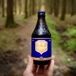
Rando bière
Hiking inspiration PRO
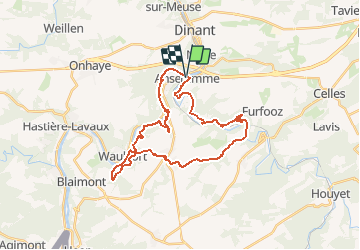

Lengte
29 km

Max. hoogte
258 m

Positief hoogteverschil
817 m
Km-Effort
40 km

Min. hoogte
88 m

Negatief hoogteverschil
816 m
Boucle
Ja
Datum van aanmaak :
2020-07-10 20:56:49.929
Laatste wijziging :
2020-07-14 11:03:10.371
8h10
Moeilijkheid : Zeer moeilijk

Gratisgps-wandelapplicatie
 SityTrail
IGN / Geografische instituten
SityTrail Plus
De wereld gaat voor u open
Over ons
Tocht Stappen van 29 km beschikbaar op Wallonië, Namen, Dinant. Deze tocht wordt voorgesteld door Rando bière.
Foto's

Plaatsbepaling
Land:
Belgium
Regio :
Wallonië
Departement/Provincie :
Namen
Gemeente :
Dinant
Locatie:
Anseremme
Vertrek:(Dec)
Vertrek:(UTM)
636019 ; 5566866 (31U) N.
Opmerkingen