


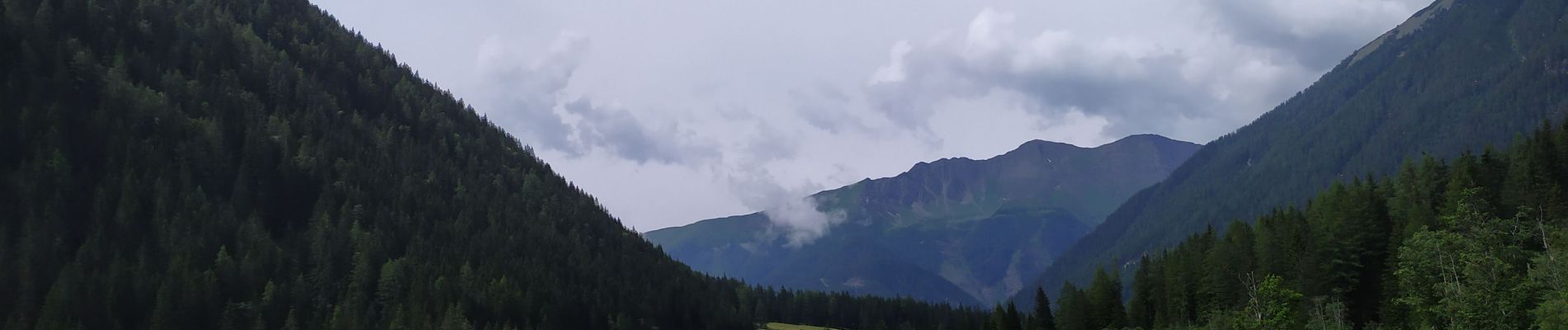
Seebach Cascades

Arnaud Dejean
Gebruiker
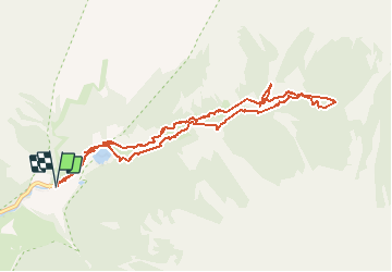

Lengte
10,3 km

Max. hoogte
1349 m

Positief hoogteverschil
150 m
Km-Effort
12,3 km

Min. hoogte
1265 m

Negatief hoogteverschil
149 m
Boucle
Ja
Datum van aanmaak :
2020-07-24 06:51:40.315
Laatste wijziging :
2020-07-24 09:25:54.149
2h19
Moeilijkheid : Heel gemakkelijk

Gratisgps-wandelapplicatie
 SityTrail
IGN / Geografische instituten
SityTrail Plus
De wereld gaat voor u open
Over ons
Tocht Stappen van 10,3 km beschikbaar op Karinthië, Bezirk Spittal an der Drau, Mallnitz. Deze tocht wordt voorgesteld door Arnaud Dejean.
Foto's


25 fotos in totaal. Klik op een foto om ze allemaal in de galerij weer te geven.
Plaatsbepaling
Land:
Austria
Regio :
Karinthië
Departement/Provincie :
Bezirk Spittal an der Drau
Gemeente :
Mallnitz
Locatie:
Unknown
Vertrek:(Dec)
Vertrek:(UTM)
362236 ; 5208373 (33T) N.
Opmerkingen