


2020-08-02 14:53:36

Blourouce
Gebruiker

Lengte
19,4 km

Max. hoogte
195 m

Positief hoogteverschil
352 m
Km-Effort
24 km

Min. hoogte
48 m

Negatief hoogteverschil
353 m
Boucle
Ja
Datum van aanmaak :
2020-08-04 16:45:27.149
Laatste wijziging :
2020-08-04 16:47:16.055
5h12
Moeilijkheid : Zeer moeilijk

Gratisgps-wandelapplicatie
 SityTrail
IGN / Geografische instituten
SityTrail Plus
De wereld gaat voor u open
Over ons
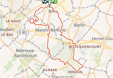
Tocht Stappen van 19,4 km beschikbaar op Hauts-de-France, Pas-de-Calais, Ruitz. Deze tocht wordt voorgesteld door Blourouce.
Plaatsbepaling
Land:
France
Regio :
Hauts-de-France
Departement/Provincie :
Pas-de-Calais
Gemeente :
Ruitz
Locatie:
Unknown
Vertrek:(Dec)
Vertrek:(UTM)
470535 ; 5590879 (31U) N.
Opmerkingen