


SityTrail - Filot 2020 essai 2

ochelen
Gebruiker

Lengte
29 km

Max. hoogte
377 m

Positief hoogteverschil
620 m
Km-Effort
37 km

Min. hoogte
143 m

Negatief hoogteverschil
619 m
Boucle
Ja
Datum van aanmaak :
2020-08-18 15:24:32.727
Laatste wijziging :
2020-08-18 15:38:29.342

Gratisgps-wandelapplicatie
 SityTrail
IGN / Geografische instituten
SityTrail Plus
De wereld gaat voor u open
Over ons
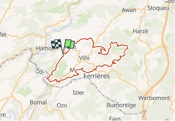
Tocht van 29 km beschikbaar op Wallonië, Luik, Hamoir. Deze tocht wordt voorgesteld door ochelen.
Beschrijving
halte au km 18


Plaatsbepaling
Land:
Belgium
Regio :
Wallonië
Departement/Provincie :
Luik
Gemeente :
Hamoir
Locatie:
Filot
Vertrek:(Dec)
Vertrek:(UTM)
681692 ; 5588329 (31U) N.
Opmerkingen