


2020 08 18 Paiolive

elorthiois
Gebruiker
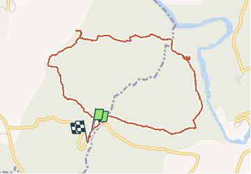

Lengte
5,7 km

Max. hoogte
251 m

Positief hoogteverschil
101 m
Km-Effort
7 km

Min. hoogte
187 m

Negatief hoogteverschil
105 m
Boucle
Ja
Datum van aanmaak :
2020-08-18 06:49:49.631
Laatste wijziging :
2020-08-23 13:47:47.44
2h42
Moeilijkheid : Heel gemakkelijk

Gratisgps-wandelapplicatie
 SityTrail
IGN / Geografische instituten
SityTrail Plus
De wereld gaat voor u open
Over ons
Tocht Stappen van 5,7 km beschikbaar op Auvergne-Rhône-Alpes, Ardèche, Les Vans. Deze tocht wordt voorgesteld door elorthiois.
Plaatsbepaling
Land:
France
Regio :
Auvergne-Rhône-Alpes
Departement/Provincie :
Ardèche
Gemeente :
Les Vans
Locatie:
Chassagnes
Vertrek:(Dec)
Vertrek:(UTM)
593848 ; 4916494 (31T) N.
Opmerkingen