


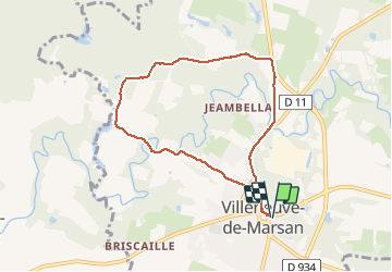
Villeneuve, le midou. trace faite

papiou
Gebruiker


1h34
Moeilijkheid : Gemakkelijk

Gratisgps-wandelapplicatie
 SityTrail
IGN / Geografische instituten
SityTrail Plus
De wereld gaat voor u open
Over ons
Tocht Stappen van 7,6 km beschikbaar op Nieuw-Aquitanië, Landes, Villeneuve-de-Marsan. Deze tocht wordt voorgesteld door papiou.
Beschrijving
comme nombre de randos dans les Landes, beaucoup de macadam avec à la fin du circuit CD dangereux. rdv sur la place et dos au tableau du descriptif de la rando prendre la rue à droite et suivre itinéraire. belle randonnée toutefois
Plaatsbepaling
Opmerkingen