


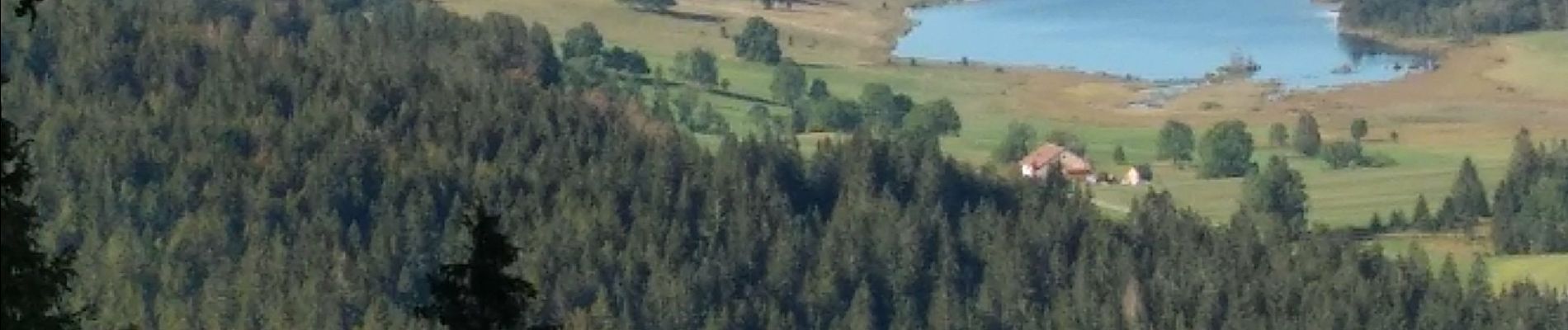
Chapelle des Bois Lac des Mortes 3 sept 2020 CAF

TRIMAILLE
Gebruiker

Lengte
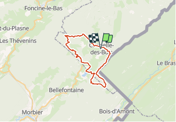
24 km

Max. hoogte
1350 m

Positief hoogteverschil
704 m
Km-Effort
34 km

Min. hoogte
1054 m

Negatief hoogteverschil
703 m
Boucle
Ja
Datum van aanmaak :
2020-09-03 07:26:57.374
Laatste wijziging :
2020-09-14 15:47:45.275
5h40
Moeilijkheid : Moeilijk

Gratisgps-wandelapplicatie
 SityTrail
IGN / Geografische instituten
SityTrail Plus
De wereld gaat voor u open
Over ons
Tocht Stappen van 24 km beschikbaar op Bourgondië-Franche-Comté, Doubs, Chapelle-des-Bois. Deze tocht wordt voorgesteld door TRIMAILLE.
Foto's


Plaatsbepaling
Land:
France
Regio :
Bourgondië-Franche-Comté
Departement/Provincie :
Doubs
Gemeente :
Chapelle-des-Bois
Locatie:
Unknown
Vertrek:(Dec)
Vertrek:(UTM)
278941 ; 5164481 (32T) N.
Opmerkingen