


col vert villard

brandy
Gebruiker
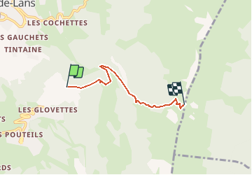

Lengte
3,7 km

Max. hoogte
1746 m

Positief hoogteverschil
546 m
Km-Effort
9,3 km

Min. hoogte
1233 m

Negatief hoogteverschil
45 m
Boucle
Neen
Datum van aanmaak :
2020-10-17 20:38:27.824
Laatste wijziging :
2020-10-17 20:39:02.954
--
Moeilijkheid : Gemakkelijk

Gratisgps-wandelapplicatie
 SityTrail
IGN / Geografische instituten
SityTrail Plus
De wereld gaat voor u open
Over ons
Tocht Te voet van 3,7 km beschikbaar op Auvergne-Rhône-Alpes, Isère, Villard-de-Lans. Deze tocht wordt voorgesteld door brandy.
Beschrijving
rando
Plaatsbepaling
Land:
France
Regio :
Auvergne-Rhône-Alpes
Departement/Provincie :
Isère
Gemeente :
Villard-de-Lans
Locatie:
Unknown
Vertrek:(Dec)
Vertrek:(UTM)
702212 ; 4992368 (31T) N.
Opmerkingen