![](/images/other/stat-length.png)
![Tocht Te voet Barbirey-sur-Ouche - barbirey - Photo](https://media.geolcdn.com/t/1900/400/ext.pjpeg?maxdim=2&url=https%3A%2F%2Fmedia.geolcdn.com%2Ff%2Fd6bd1c62-1edb-4936-a48f-393652ec8299.jpg)
barbirey
mpstoop
Gebruiker
![Lengte](/images/other/stat-length.png)
Lengte
15,5 km
![Max. hoogte](https://static1.geolcdn.com/siteimages/upload/files/1508320355ic_sort_altitude_max_24dp.png)
Max. hoogte
586 m
![Positief hoogteverschil](https://static1.geolcdn.com/siteimages/upload/files/1508320355ic_sort_den_pos_24dp.png)
Positief hoogteverschil
593 m
![Km-Effort](/images/other/stat-length.png)
Km-Effort
23 km
![Min. hoogte](https://static1.geolcdn.com/siteimages/upload/files/1508320355ic_sort_altitude_min_24dp.png)
Min. hoogte
313 m
![Negatief hoogteverschil](https://static1.geolcdn.com/siteimages/upload/files/1508320355ic_sort_den_neg_24dp.png)
Negatief hoogteverschil
601 m
![Boucle](https://static1.geolcdn.com/siteimages/upload/files/16400158638029165_repeat_loop_refresh_sync_direction_icon.png)
Boucle
Ja
Datum van aanmaak :
2020-10-23 07:46:24.01
Laatste wijziging :
2020-10-23 07:58:03.402
![Te voet](https://static1.geolcdn.com/sitytour/trail-icons/100.png)
2m
Moeilijkheid : Medium
![Stappen](https://static1.geolcdn.com/sitytour/trail-icons/101.png)
4h52
Moeilijkheid : Zeer moeilijk
![Scan deze QR-code om de tocht te openen in de SityTrail-applicatie](https://capi.geolives.com/qq0zvz2zws4bq2lad0pu/sitytour/trails/2585182/qr.png?size=200)
Gratisgps-wandelapplicatie
Over ons
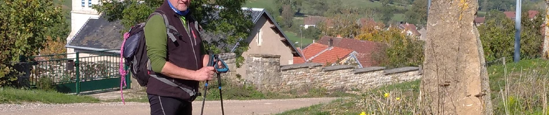
Tocht Te voet van 15,5 km beschikbaar op Bourgondië-Franche-Comté, Côte-d'Or, Barbirey-sur-Ouche. Deze tocht wordt voorgesteld door mpstoop.
Beschrijving
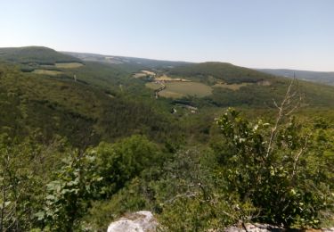
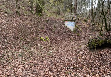
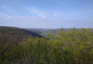
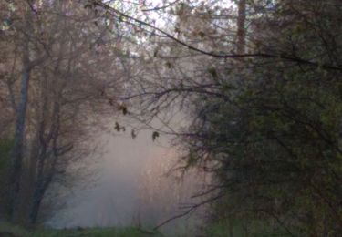
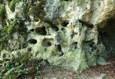
depart chateau, trou qui fume, La Montagne/, le Chatelet hors sentier/grenand les sombernon, foret de Veluze par grande cabane de chasse, retour
Plaatsbepaling
Land:
France
Regio :
Bourgondië-Franche-Comté
Departement/Provincie :
Côte-d'Or
Gemeente :
Barbirey-sur-Ouche
Locatie:
Unknown
Vertrek:(Dec)
Vertrek:(UTM)
632772 ; 5234783 (31T) N.
Opmerkingen
Wandeltochten in de omgeving
![Tocht Stappen Sainte-Marie-sur-Ouche - Pont de Pany - Photo](https://media.geolcdn.com/t/375/260/ext.jpg?maxdim=2&url=https%3A%2F%2Fmedia.geolcdn.com%2Ff%2F880c73c5-f480-4d0e-b6d7-7819f4768403.jpg)
![Stappen Stappen](https://static1.geolcdn.com/sitytour/trail-icons/101.png)
Pont de Pany
Stappen
Gemakkelijk
(1)
Sainte-Marie-sur-Ouche,
Bourgondië-Franche-Comté,
Côte-d'Or,
France
![](/images/other/stat-length.png)
11,4 km | 16 km-effort
3h 19min
![](https://static1.geolcdn.com/siteimages/upload/files/16400158638029165_repeat_loop_refresh_sync_direction_icon.png)
Ja
![Tocht Stappen Barbirey-sur-Ouche - Le Tour de Barbiriacum - Barbirey sur Ouche - Photo](https://media.geolcdn.com/t/375/260/ext.jpg?maxdim=2&url=https%3A%2F%2Fservices.sitytrail.com%2FGeolivesWS%2FDownloadMedia.ashx%3FTrailID%3D104688%26Media%3D8091_1.jpg)
![Stappen Stappen](https://static1.geolcdn.com/sitytour/trail-icons/101.png)
Le Tour de Barbiriacum - Barbirey sur Ouche
Stappen
Medium
(1)
Barbirey-sur-Ouche,
Bourgondië-Franche-Comté,
Côte-d'Or,
France
![](/images/other/stat-length.png)
10,5 km | 15,9 km-effort
2h 45min
![](https://static1.geolcdn.com/siteimages/upload/files/16400158638029165_repeat_loop_refresh_sync_direction_icon.png)
Ja
![Tocht Stappen Sainte-Marie-sur-Ouche - Belvédères sur la vallée de l'Ouche - Pont de Pany - Photo](https://media.geolcdn.com/t/375/260/ext.jpg?maxdim=2&url=https%3A%2F%2Fservices.sitytrail.com%2FGeolivesWS%2FDownloadMedia.ashx%3FTrailID%3D104685%26Media%3D8088_1.jpg)
![Stappen Stappen](https://static1.geolcdn.com/sitytour/trail-icons/101.png)
Belvédères sur la vallée de l'Ouche - Pont de Pany
Stappen
Moeilijk
(1)
Sainte-Marie-sur-Ouche,
Bourgondië-Franche-Comté,
Côte-d'Or,
France
![](/images/other/stat-length.png)
20 km | 28 km-effort
6h 0min
![](https://static1.geolcdn.com/siteimages/upload/files/16400158638029165_repeat_loop_refresh_sync_direction_icon.png)
Ja
![Tocht Stappen La Bussière-sur-Ouche - La Bête de l'Auxois - La Bussière sur Ouche - Photo](https://media.geolcdn.com/t/375/260/ext.jpg?maxdim=2&url=https%3A%2F%2Fservices.sitytrail.com%2FGeolivesWS%2FDownloadMedia.ashx%3FTrailID%3D104674%26Media%3D8077_1.jpg)
![Stappen Stappen](https://static1.geolcdn.com/sitytour/trail-icons/101.png)
La Bête de l'Auxois - La Bussière sur Ouche
Stappen
Moeilijk
(1)
La Bussière-sur-Ouche,
Bourgondië-Franche-Comté,
Côte-d'Or,
France
![](/images/other/stat-length.png)
25 km | 33 km-effort
6h 0min
![](https://static1.geolcdn.com/siteimages/upload/files/16400158638029165_repeat_loop_refresh_sync_direction_icon.png)
Ja
![Tocht Stappen Grenant-lès-Sombernon - Grenant les sombernon - Photo](https://media.geolcdn.com/t/375/260/ext.jpg?maxdim=2&url=https%3A%2F%2Fmedia.geolcdn.com%2Ff%2Fdf59c81b-a7ed-408e-9f72-9695d8a9e535.jpg)
![Stappen Stappen](https://static1.geolcdn.com/sitytour/trail-icons/101.png)
Grenant les sombernon
Stappen
Grenant-lès-Sombernon,
Bourgondië-Franche-Comté,
Côte-d'Or,
France
![](/images/other/stat-length.png)
14 km | 21 km-effort
3h 35min
![](https://static1.geolcdn.com/siteimages/upload/files/16400158638029165_repeat_loop_refresh_sync_direction_icon.png)
Ja
![Tocht Stappen La Bussière-sur-Ouche - Pierre du druide , grotte de tebsima - Photo](https://media.geolcdn.com/t/375/260/ext.jpg?maxdim=2&url=https%3A%2F%2Fmedia.geolcdn.com%2Ff%2Ff5fb0392-9ba6-4c1e-8853-76c9bb7fb3dc.jpg)
![Stappen Stappen](https://static1.geolcdn.com/sitytour/trail-icons/101.png)
Pierre du druide , grotte de tebsima
Stappen
Medium
La Bussière-sur-Ouche,
Bourgondië-Franche-Comté,
Côte-d'Or,
France
![](/images/other/stat-length.png)
15,9 km | 23 km-effort
3h 32min
![](https://static1.geolcdn.com/siteimages/upload/files/16400158638029165_repeat_loop_refresh_sync_direction_icon.png)
Ja
![Tocht Stappen Saint-Jean-de-Bœuf - Saint JeandeBoeuf-Gissey sur Ouche - Photo](https://media.geolcdn.com/t/375/260/ext.jpg?maxdim=2&url=https%3A%2F%2Fmedia.geolcdn.com%2Ff%2F8855f220-19b7-4cb5-9740-2586f5619cf3.jpg)
![Stappen Stappen](https://static1.geolcdn.com/sitytour/trail-icons/101.png)
Saint JeandeBoeuf-Gissey sur Ouche
Stappen
Medium
Saint-Jean-de-Bœuf,
Bourgondië-Franche-Comté,
Côte-d'Or,
France
![](/images/other/stat-length.png)
22 km | 31 km-effort
8h 5min
![](https://static1.geolcdn.com/siteimages/upload/files/16400158638029165_repeat_loop_refresh_sync_direction_icon.png)
Ja
![Tocht Stappen Gergueil - balcon de l'Ouche - Photo](https://media.geolcdn.com/t/375/260/ext.jpg?maxdim=2&url=https%3A%2F%2Fmedia.geolcdn.com%2Ff%2F946ea50b-5544-4ca8-84ea-d0bce9713232.jpg)
![Stappen Stappen](https://static1.geolcdn.com/sitytour/trail-icons/101.png)
balcon de l'Ouche
Stappen
Zeer moeilijk
Gergueil,
Bourgondië-Franche-Comté,
Côte-d'Or,
France
![](/images/other/stat-length.png)
38 km | 50 km-effort
9h 28min
![](https://static1.geolcdn.com/siteimages/upload/files/16400158638029165_repeat_loop_refresh_sync_direction_icon.png)
Neen
![Tocht Stappen Barbirey-sur-Ouche - Tebzima - Photo](https://media.geolcdn.com/t/375/260/ext.jpg?maxdim=2&url=https%3A%2F%2Fservices.sitytrail.com%2FGeolivesWS%2FDownloadMedia.ashx%3FTrailID%3D1013095%26Media%3D20180730104607.jpg)
![Stappen Stappen](https://static1.geolcdn.com/sitytour/trail-icons/101.png)
Tebzima
Stappen
Medium
Barbirey-sur-Ouche,
Bourgondië-Franche-Comté,
Côte-d'Or,
France
![](/images/other/stat-length.png)
13,4 km | 20 km-effort
4h 11min
![](https://static1.geolcdn.com/siteimages/upload/files/16400158638029165_repeat_loop_refresh_sync_direction_icon.png)
Ja