


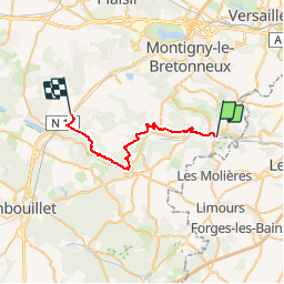
ST REMY LES CHEVREUSE - LES ESSARTS LE ROI

NUITEVEN
Gebruiker

Lengte
26 km

Max. hoogte
187 m

Positief hoogteverschil
562 m
Km-Effort
33 km

Min. hoogte
72 m

Negatief hoogteverschil
469 m
Boucle
Neen
Datum van aanmaak :
2014-12-10 00:00:00.0
Laatste wijziging :
2014-12-10 00:00:00.0
7h00
Moeilijkheid : Medium

Gratisgps-wandelapplicatie
 SityTrail
IGN / Geografische instituten
SityTrail Plus
De wereld gaat voor u open
Over ons
Tocht Stappen van 26 km beschikbaar op Île-de-France, Yvelines, Saint-Rémy-lès-Chevreuse. Deze tocht wordt voorgesteld door NUITEVEN.
Plaatsbepaling
Land:
France
Regio :
Île-de-France
Departement/Provincie :
Yvelines
Gemeente :
Saint-Rémy-lès-Chevreuse
Locatie:
Unknown
Vertrek:(Dec)
Vertrek:(UTM)
431641 ; 5394849 (31U) N.
Opmerkingen