


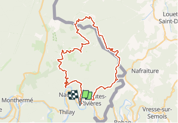
Prépa GTLC (35Km/1200D+)

choumac08
Gebruiker

Lengte
36 km

Max. hoogte
513 m

Positief hoogteverschil
1205 m
Km-Effort
52 km

Min. hoogte
160 m

Negatief hoogteverschil
1206 m
Boucle
Ja
Datum van aanmaak :
2021-02-23 20:14:28.155
Laatste wijziging :
2021-03-02 18:23:59.252
--
Moeilijkheid : Moeilijk

Gratisgps-wandelapplicatie
 SityTrail
IGN / Geografische instituten
SityTrail Plus
De wereld gaat voor u open
Over ons
Tocht Trail van 36 km beschikbaar op Grand Est, Ardennes, Thilay. Deze tocht wordt voorgesteld door choumac08.
Plaatsbepaling
Land:
France
Regio :
Grand Est
Departement/Provincie :
Ardennes
Gemeente :
Thilay
Locatie:
Unknown
Vertrek:(Dec)
Vertrek:(UTM)
631236 ; 5526800 (31U) N.
Opmerkingen