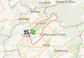
AS06 Boucle des Sarts

Trails in Esneux
Discover trails in Esneux GUIDE+

Lengte
10,9 km

Max. hoogte
283 m

Positief hoogteverschil
200 m
Km-Effort
13,5 km

Min. hoogte
181 m

Negatief hoogteverschil
191 m
Boucle
Ja
Datum van aanmaak :
2021-03-08 10:52:21.74
Laatste wijziging :
2021-03-08 10:56:30.191
3h00
Moeilijkheid : Medium
1h00
Moeilijkheid : Gemakkelijk

Gratisgps-wandelapplicatie
 SityTrail
IGN / Geografische instituten
SityTrail Plus
De wereld gaat voor u open
Over ons
Tocht Te voet van 10,9 km beschikbaar op Wallonië, Luik, Anthisnes. Deze tocht wordt voorgesteld door Trails in Esneux.
Beschrijving
Suivez le balisage Losange Vert.
Plaatsbepaling
Land:
Belgium
Regio :
Wallonië
Departement/Provincie :
Luik
Gemeente :
Anthisnes
Locatie:
Tavier
Vertrek:(Dec)
Vertrek:(UTM)
675639 ; 5596544 (31U) N.
Opmerkingen