


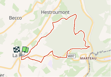
SityTrail - La Reid

Efr
Gebruiker

Lengte
9 km

Max. hoogte
372 m

Positief hoogteverschil
225 m
Km-Effort
12 km

Min. hoogte
256 m

Negatief hoogteverschil
225 m
Boucle
Ja
Datum van aanmaak :
2021-04-05 20:14:05.255
Laatste wijziging :
2021-04-18 19:21:14.478
2h43
Moeilijkheid : Gemakkelijk

Gratisgps-wandelapplicatie
 SityTrail
IGN / Geografische instituten
SityTrail Plus
De wereld gaat voor u open
Over ons
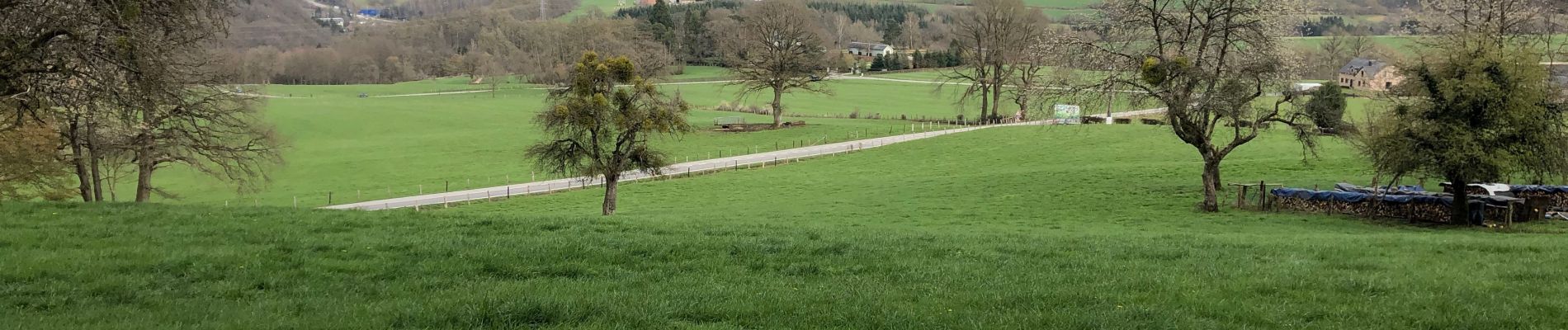
Tocht Te voet van 9 km beschikbaar op Wallonië, Luik, Theux. Deze tocht wordt voorgesteld door Efr.
Beschrijving
Facile
Foto's


Plaatsbepaling
Land:
Belgium
Regio :
Wallonië
Departement/Provincie :
Luik
Gemeente :
Theux
Locatie:
La Reid
Vertrek:(Dec)
Vertrek:(UTM)
697984 ; 5596732 (31U) N.
Opmerkingen