


1#Les hauteurs d'Argences

yannick-p
Gebruiker

Lengte
4,2 km

Max. hoogte
72 m

Positief hoogteverschil
28 m
Km-Effort
4,6 km

Min. hoogte
59 m

Negatief hoogteverschil
28 m
Boucle
Ja
Datum van aanmaak :
2021-04-15 20:43:53.921
Laatste wijziging :
2021-06-04 10:01:28.403
2h00
Moeilijkheid : Gemakkelijk

Gratisgps-wandelapplicatie
 SityTrail
IGN / Geografische instituten
SityTrail Plus
De wereld gaat voor u open
Over ons
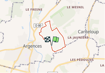
Tocht Geocaching van 4,2 km beschikbaar op Normandië, Calvados, Argences. Deze tocht wordt voorgesteld door yannick-p.
Beschrijving
Petit circuit de géocaching de 20 caches.
Plaatsbepaling
Land:
France
Regio :
Normandië
Departement/Provincie :
Calvados
Gemeente :
Argences
Locatie:
Unknown
Vertrek:(Dec)
Vertrek:(UTM)
707715 ; 5445478 (30U) N.
Opmerkingen