


GR10 Estérençubi col d'Irau

winkelmuller
Gebruiker
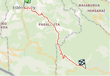

Lengte
11,3 km

Max. hoogte
1026 m

Positief hoogteverschil
975 m
Km-Effort
22 km

Min. hoogte
237 m

Negatief hoogteverschil
193 m
Boucle
Neen
Datum van aanmaak :
2021-04-27 13:28:48.429
Laatste wijziging :
2021-04-27 16:02:20.846
4h55
Moeilijkheid : Moeilijk

Gratisgps-wandelapplicatie
 SityTrail
IGN / Geografische instituten
SityTrail Plus
De wereld gaat voor u open
Over ons
Tocht Stappen van 11,3 km beschikbaar op Nieuw-Aquitanië, Pyrénées-Atlantiques, Estérençuby. Deze tocht wordt voorgesteld door winkelmuller.
Plaatsbepaling
Land:
France
Regio :
Nieuw-Aquitanië
Departement/Provincie :
Pyrénées-Atlantiques
Gemeente :
Estérençuby
Locatie:
Unknown
Vertrek:(Dec)
Vertrek:(UTM)
646815 ; 4773971 (30T) N.
Opmerkingen