


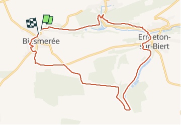
Biesmeree Adeps magnifique

thomarche
Gebruiker

Lengte
10 km

Max. hoogte
278 m

Positief hoogteverschil
146 m
Km-Effort
11,9 km

Min. hoogte
195 m

Negatief hoogteverschil
146 m
Boucle
Ja
Datum van aanmaak :
2021-06-20 15:17:20.0
Laatste wijziging :
2021-06-20 17:35:29.436
2h17
Moeilijkheid : Medium

Gratisgps-wandelapplicatie
 SityTrail
IGN / Geografische instituten
SityTrail Plus
De wereld gaat voor u open
Over ons
Tocht Stappen van 10 km beschikbaar op Wallonië, Namen, Mettet. Deze tocht wordt voorgesteld door thomarche.
Beschrijving
Ravel non aménagé, sentiers magnifiques, abbaye, petit château, champs. Peu macadam et très très calme.
Plaatsbepaling
Land:
Belgium
Regio :
Wallonië
Departement/Provincie :
Namen
Gemeente :
Mettet
Locatie:
Unknown
Vertrek:(Dec)
Vertrek:(UTM)
619727 ; 5573314 (31U) N.
Opmerkingen