


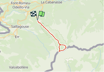

24 km | 43 km-effort

Gebruiker


Gratisgps-wandelapplicatie
 SityTrail
IGN / Geografische instituten
SityTrail World
De wereld gaat voor u open
Tocht Stappen van 21 km beschikbaar op Occitanië, Pyrénées-Orientales, Eyne. Deze tocht wordt voorgesteld door ThonyM.
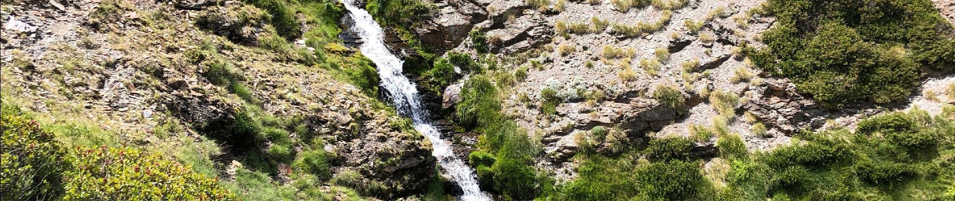
Ce fut un merveilleux rendez-vous avec la faune


Stappen

Sneeuwschoenen

Stappen

Sneeuwschoenen

Stappen

Stappen

Stappen

Mountainbike

Stappen