


conches en ouche

werth
Gebruiker

Lengte
44 km

Max. hoogte
209 m

Positief hoogteverschil
374 m
Km-Effort
49 km

Min. hoogte
116 m

Negatief hoogteverschil
389 m
Boucle
Neen
Datum van aanmaak :
2021-07-25 09:42:22.935
Laatste wijziging :
2021-07-27 08:38:10.703
5h14
Moeilijkheid : Medium

Gratisgps-wandelapplicatie
 SityTrail
IGN / Geografische instituten
SityTrail Plus
De wereld gaat voor u open
Over ons
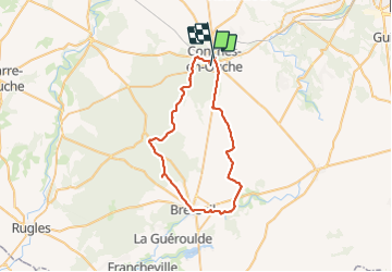
Tocht Wegfiets van 44 km beschikbaar op Normandië, Eure, Conches-en-Ouche. Deze tocht wordt voorgesteld door werth.
Plaatsbepaling
Land:
France
Regio :
Normandië
Departement/Provincie :
Eure
Gemeente :
Conches-en-Ouche
Locatie:
Unknown
Vertrek:(Dec)
Vertrek:(UTM)
348920 ; 5424682 (31U) N.
Opmerkingen