


2021-08-05_11h13m16_t50557760_hunspach et la ligne

chlafaille
Gebruiker
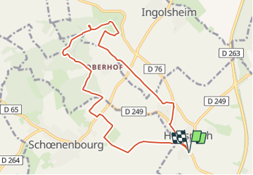

Lengte
9,3 km

Max. hoogte
219 m

Positief hoogteverschil
127 m
Km-Effort
11 km

Min. hoogte
152 m

Negatief hoogteverschil
127 m
Boucle
Ja
Datum van aanmaak :
2021-08-05 09:13:16.72
Laatste wijziging :
2021-08-05 09:13:18.789

Gratisgps-wandelapplicatie
 SityTrail
IGN / Geografische instituten
SityTrail Plus
De wereld gaat voor u open
Over ons
Tocht van 9,3 km beschikbaar op Grand Est, Bas-Rhin, Hunspach. Deze tocht wordt voorgesteld door chlafaille.
Plaatsbepaling
Land:
France
Regio :
Grand Est
Departement/Provincie :
Bas-Rhin
Gemeente :
Hunspach
Locatie:
Unknown
Vertrek:(Dec)
Vertrek:(UTM)
422528 ; 5422507 (32U) N.
Opmerkingen