


Saint Malo-03 Lawrence d'Arabie

nicolas54230
Gebruiker

Lengte
13,9 km

Max. hoogte
48 m

Positief hoogteverschil
189 m
Km-Effort
16,5 km

Min. hoogte
0 m

Negatief hoogteverschil
186 m
Boucle
Ja
Datum van aanmaak :
2021-08-10 18:23:47.114
Laatste wijziging :
2022-09-19 16:54:50.267
3h44
Moeilijkheid : Gemakkelijk

Gratisgps-wandelapplicatie
 SityTrail
IGN / Geografische instituten
SityTrail Plus
De wereld gaat voor u open
Over ons
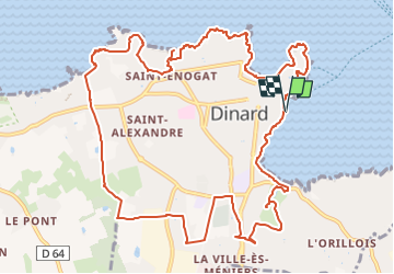
Tocht Te voet van 13,9 km beschikbaar op Bretagne, Ille-et-Vilaine, Dinard. Deze tocht wordt voorgesteld door nicolas54230.
Plaatsbepaling
Land:
France
Regio :
Bretagne
Departement/Provincie :
Ille-et-Vilaine
Gemeente :
Dinard
Locatie:
Unknown
Vertrek:(Dec)
Vertrek:(UTM)
569940 ; 5386993 (30U) N.
Opmerkingen