


randonnee-st-michel-de-chabrillanoux-les-belvederes nMVVYmMNtY4fACzh8d3-Xw

Linerou
Gebruiker

Lengte
11,8 km

Max. hoogte
547 m

Positief hoogteverschil
575 m
Km-Effort
19,4 km

Min. hoogte
190 m

Negatief hoogteverschil
573 m
Boucle
Ja
Datum van aanmaak :
2021-08-13 17:40:31.76
Laatste wijziging :
2021-08-13 17:41:55.703
4h24
Moeilijkheid : Moeilijk

Gratisgps-wandelapplicatie
 SityTrail
IGN / Geografische instituten
SityTrail Plus
De wereld gaat voor u open
Over ons
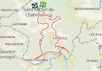
Tocht Stappen van 11,8 km beschikbaar op Auvergne-Rhône-Alpes, Ardèche, Saint-Michel-de-Chabrillanoux. Deze tocht wordt voorgesteld door Linerou.
Plaatsbepaling
Land:
France
Regio :
Auvergne-Rhône-Alpes
Departement/Provincie :
Ardèche
Gemeente :
Saint-Michel-de-Chabrillanoux
Locatie:
Unknown
Vertrek:(Dec)
Vertrek:(UTM)
626656 ; 4966439 (31T) N.
Opmerkingen