


1 # Le gros hêtre.

yannick-p
Gebruiker

Lengte
6,3 km

Max. hoogte
172 m

Positief hoogteverschil
217 m
Km-Effort
9,2 km

Min. hoogte
57 m

Negatief hoogteverschil
217 m
Boucle
Ja
Datum van aanmaak :
2021-08-13 21:47:13.758
Laatste wijziging :
2021-08-13 21:48:34.599
--
Moeilijkheid : Gemakkelijk

Gratisgps-wandelapplicatie
 SityTrail
IGN / Geografische instituten
SityTrail Plus
De wereld gaat voor u open
Over ons
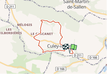
Tocht Geocaching van 6,3 km beschikbaar op Normandië, Calvados, Culey-le-Patry. Deze tocht wordt voorgesteld door yannick-p.
Plaatsbepaling
Land:
France
Regio :
Normandië
Departement/Provincie :
Calvados
Gemeente :
Culey-le-Patry
Locatie:
Unknown
Vertrek:(Dec)
Vertrek:(UTM)
681196 ; 5424672 (30U) N.
Opmerkingen