


Fontaine de l'ours et belvederes bragouse

guariso
Gebruiker

Lengte
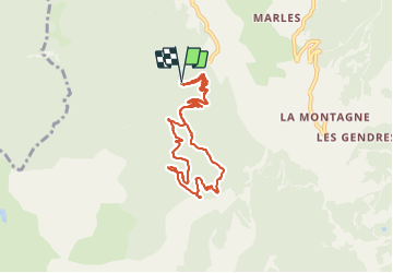
8,7 km

Max. hoogte
1598 m

Positief hoogteverschil
430 m
Km-Effort
14,4 km

Min. hoogte
1203 m

Negatief hoogteverschil
428 m
Boucle
Ja
Datum van aanmaak :
2021-08-19 06:54:17.651
Laatste wijziging :
2021-08-19 10:47:53.712
3h04
Moeilijkheid : Gemakkelijk

Gratisgps-wandelapplicatie
 SityTrail
IGN / Geografische instituten
SityTrail Plus
De wereld gaat voor u open
Over ons
Tocht Stappen van 8,7 km beschikbaar op Provence-Alpes-Côte d'Azur, Hautes-Alpes, Crots. Deze tocht wordt voorgesteld door guariso.
Beschrijving
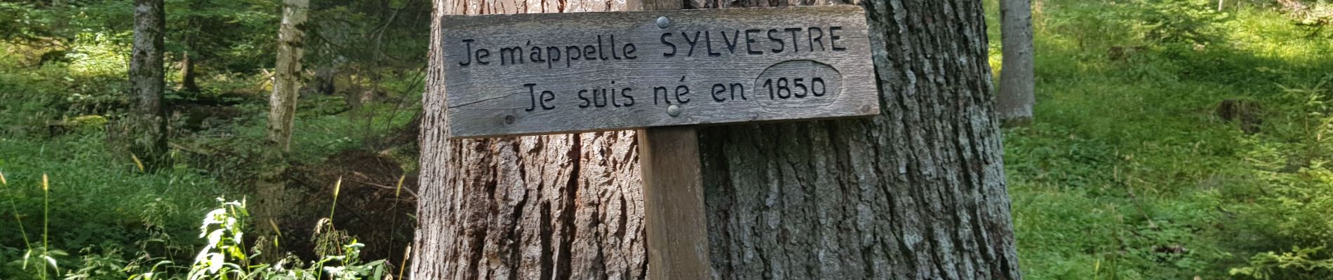
balade en sous bois de pins et mélèzes. durée indiquée avec arrêts aux 3 belvederes
Foto's


Plaatsbepaling
Land:
France
Regio :
Provence-Alpes-Côte d'Azur
Departement/Provincie :
Hautes-Alpes
Gemeente :
Crots
Locatie:
Unknown
Vertrek:(Dec)
Vertrek:(UTM)
297402 ; 4930297 (32T) N.
Opmerkingen