


Vesseaux La Louyre 19km

thonyc
Gebruiker GUIDE
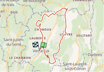

Lengte
18,5 km

Max. hoogte
683 m

Positief hoogteverschil
596 m
Km-Effort
26 km

Min. hoogte
267 m

Negatief hoogteverschil
592 m
Boucle
Ja
Datum van aanmaak :
2021-08-25 06:47:23.078
Laatste wijziging :
2021-08-26 16:06:18.401
6h34
Moeilijkheid : Medium

Gratisgps-wandelapplicatie
 SityTrail
IGN / Geografische instituten
SityTrail Plus
De wereld gaat voor u open
Over ons
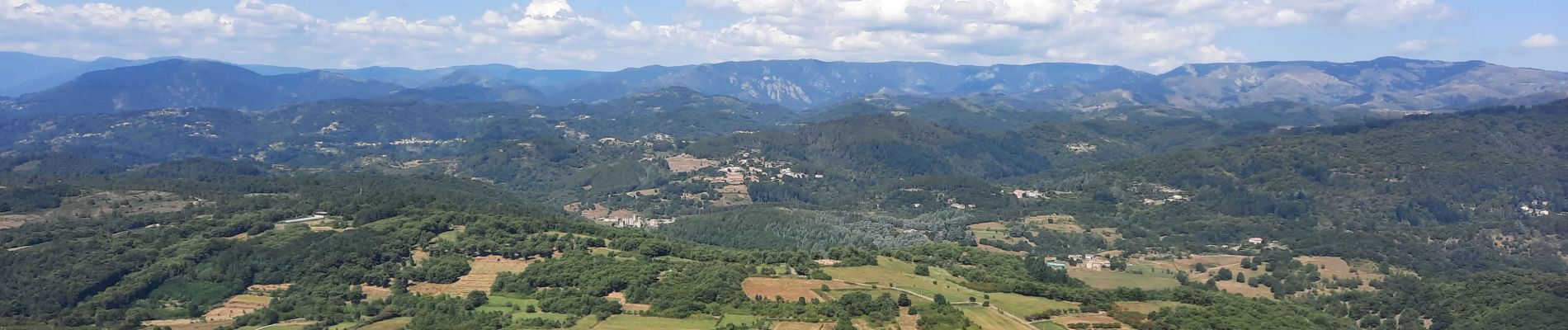
Tocht Stappen van 18,5 km beschikbaar op Auvergne-Rhône-Alpes, Ardèche, Vesseaux. Deze tocht wordt voorgesteld door thonyc.
Foto's


Plaatsbepaling
Land:
France
Regio :
Auvergne-Rhône-Alpes
Departement/Provincie :
Ardèche
Gemeente :
Vesseaux
Locatie:
Unknown
Vertrek:(Dec)
Vertrek:(UTM)
614172 ; 4945102 (31T) N.
Opmerkingen