


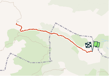

5,4 km | 7,4 km-effort

Gebruiker GUIDE


Gratisgps-wandelapplicatie
 SityTrail
IGN / Geografische instituten
SityTrail World
De wereld gaat voor u open
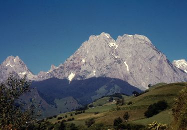
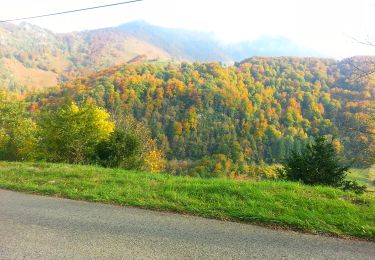
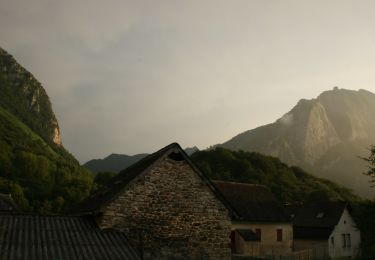
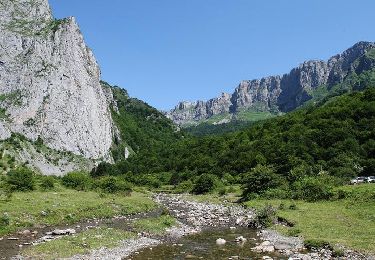
Tocht Stappen van 9,4 km beschikbaar op Nieuw-Aquitanië, Pyrénées-Atlantiques, Lescun. Deze tocht wordt voorgesteld door marmotte65.
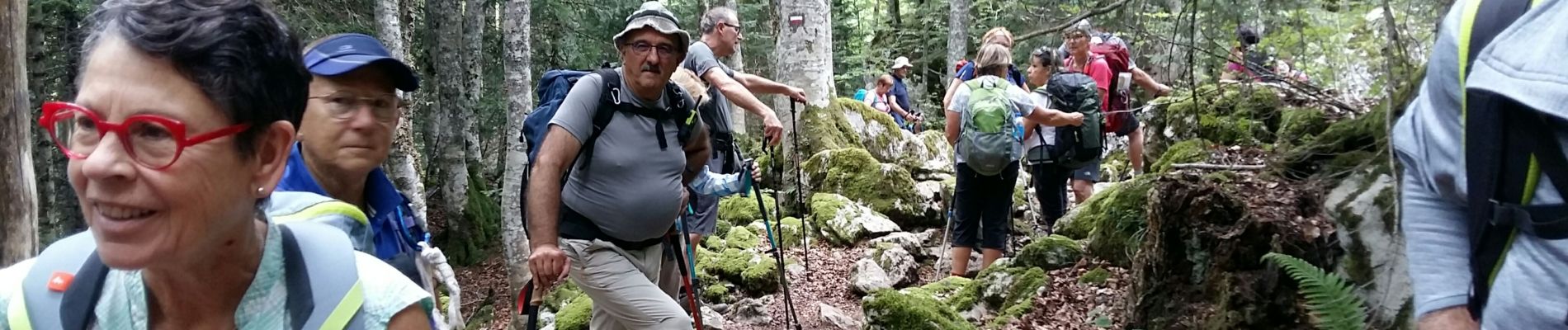
une belle réussite cette rando avec regroupement des G3 et G4 pour un PN en commun. Pas de difficulté particuliere, si ce n'est pas pente un peu raide apres la cabane du pla dela baitch, en direction du pas d'Azun
 "
data-pinterest-text="Pin it"
data-tweet-text="share on twitter"
data-facebook-share-url="https://www.sitytrail.com/nl/trails/2915056-lescun--lescun-laberouat-pas-d-azun-lpc-g3xg4--x2915056x/?photo=1#lg=1&slide=1"
data-twitter-share-url="https://www.sitytrail.com/nl/trails/2915056-lescun--lescun-laberouat-pas-d-azun-lpc-g3xg4--x2915056x/?photo=1#lg=1&slide=1"
data-googleplus-share-url="https://www.sitytrail.com/nl/trails/2915056-lescun--lescun-laberouat-pas-d-azun-lpc-g3xg4--x2915056x/?photo=1#lg=1&slide=1"
data-pinterest-share-url="https://www.sitytrail.com/nl/trails/2915056-lescun--lescun-laberouat-pas-d-azun-lpc-g3xg4--x2915056x/?photo=1#lg=1&slide=1">
"
data-pinterest-text="Pin it"
data-tweet-text="share on twitter"
data-facebook-share-url="https://www.sitytrail.com/nl/trails/2915056-lescun--lescun-laberouat-pas-d-azun-lpc-g3xg4--x2915056x/?photo=1#lg=1&slide=1"
data-twitter-share-url="https://www.sitytrail.com/nl/trails/2915056-lescun--lescun-laberouat-pas-d-azun-lpc-g3xg4--x2915056x/?photo=1#lg=1&slide=1"
data-googleplus-share-url="https://www.sitytrail.com/nl/trails/2915056-lescun--lescun-laberouat-pas-d-azun-lpc-g3xg4--x2915056x/?photo=1#lg=1&slide=1"
data-pinterest-share-url="https://www.sitytrail.com/nl/trails/2915056-lescun--lescun-laberouat-pas-d-azun-lpc-g3xg4--x2915056x/?photo=1#lg=1&slide=1">
 "
data-pinterest-text="Pin it"
data-tweet-text="share on twitter"
data-facebook-share-url="https://www.sitytrail.com/nl/trails/2915056-lescun--lescun-laberouat-pas-d-azun-lpc-g3xg4--x2915056x/?photo=2#lg=1&slide=2"
data-twitter-share-url="https://www.sitytrail.com/nl/trails/2915056-lescun--lescun-laberouat-pas-d-azun-lpc-g3xg4--x2915056x/?photo=2#lg=1&slide=2"
data-googleplus-share-url="https://www.sitytrail.com/nl/trails/2915056-lescun--lescun-laberouat-pas-d-azun-lpc-g3xg4--x2915056x/?photo=2#lg=1&slide=2"
data-pinterest-share-url="https://www.sitytrail.com/nl/trails/2915056-lescun--lescun-laberouat-pas-d-azun-lpc-g3xg4--x2915056x/?photo=2#lg=1&slide=2">
"
data-pinterest-text="Pin it"
data-tweet-text="share on twitter"
data-facebook-share-url="https://www.sitytrail.com/nl/trails/2915056-lescun--lescun-laberouat-pas-d-azun-lpc-g3xg4--x2915056x/?photo=2#lg=1&slide=2"
data-twitter-share-url="https://www.sitytrail.com/nl/trails/2915056-lescun--lescun-laberouat-pas-d-azun-lpc-g3xg4--x2915056x/?photo=2#lg=1&slide=2"
data-googleplus-share-url="https://www.sitytrail.com/nl/trails/2915056-lescun--lescun-laberouat-pas-d-azun-lpc-g3xg4--x2915056x/?photo=2#lg=1&slide=2"
data-pinterest-share-url="https://www.sitytrail.com/nl/trails/2915056-lescun--lescun-laberouat-pas-d-azun-lpc-g3xg4--x2915056x/?photo=2#lg=1&slide=2">
 "
data-pinterest-text="Pin it"
data-tweet-text="share on twitter"
data-facebook-share-url="https://www.sitytrail.com/nl/trails/2915056-lescun--lescun-laberouat-pas-d-azun-lpc-g3xg4--x2915056x/?photo=3#lg=1&slide=3"
data-twitter-share-url="https://www.sitytrail.com/nl/trails/2915056-lescun--lescun-laberouat-pas-d-azun-lpc-g3xg4--x2915056x/?photo=3#lg=1&slide=3"
data-googleplus-share-url="https://www.sitytrail.com/nl/trails/2915056-lescun--lescun-laberouat-pas-d-azun-lpc-g3xg4--x2915056x/?photo=3#lg=1&slide=3"
data-pinterest-share-url="https://www.sitytrail.com/nl/trails/2915056-lescun--lescun-laberouat-pas-d-azun-lpc-g3xg4--x2915056x/?photo=3#lg=1&slide=3">
"
data-pinterest-text="Pin it"
data-tweet-text="share on twitter"
data-facebook-share-url="https://www.sitytrail.com/nl/trails/2915056-lescun--lescun-laberouat-pas-d-azun-lpc-g3xg4--x2915056x/?photo=3#lg=1&slide=3"
data-twitter-share-url="https://www.sitytrail.com/nl/trails/2915056-lescun--lescun-laberouat-pas-d-azun-lpc-g3xg4--x2915056x/?photo=3#lg=1&slide=3"
data-googleplus-share-url="https://www.sitytrail.com/nl/trails/2915056-lescun--lescun-laberouat-pas-d-azun-lpc-g3xg4--x2915056x/?photo=3#lg=1&slide=3"
data-pinterest-share-url="https://www.sitytrail.com/nl/trails/2915056-lescun--lescun-laberouat-pas-d-azun-lpc-g3xg4--x2915056x/?photo=3#lg=1&slide=3">


Stappen

Stappen
Te voet
Te voet
Te voet
Te voet
Te voet
Te voet
Stappen