


20210909

Frings
Gebruiker

Lengte
7,2 km

Max. hoogte
2839 m

Positief hoogteverschil
625 m
Km-Effort
15,3 km

Min. hoogte
2283 m

Negatief hoogteverschil
552 m
Boucle
Neen
Datum van aanmaak :
2021-09-09 06:55:27.508
Laatste wijziging :
2021-09-09 12:59:21.569
5h25
Moeilijkheid : Moeilijk

Gratisgps-wandelapplicatie
 SityTrail
IGN / Geografische instituten
SityTrail Plus
De wereld gaat voor u open
Over ons
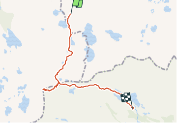
Tocht Stappen van 7,2 km beschikbaar op Catalonië, Lerida, Alt Àneu. Deze tocht wordt voorgesteld door Frings.
Plaatsbepaling
Land:
Spain
Regio :
Catalonië
Departement/Provincie :
Lerida
Gemeente :
Alt Àneu
Locatie:
Unknown
Vertrek:(Dec)
Vertrek:(UTM)
332952 ; 4720728 (31T) N.
Opmerkingen