


20210910

Frings
Gebruiker
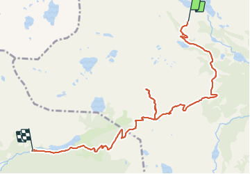

Lengte
9,9 km

Max. hoogte
2705 m

Positief hoogteverschil
576 m
Km-Effort
18,7 km

Min. hoogte
1991 m

Negatief hoogteverschil
918 m
Boucle
Neen
Datum van aanmaak :
2021-09-10 06:57:24.904
Laatste wijziging :
2021-09-18 09:08:08.863
6h35
Moeilijkheid : Moeilijk

Gratisgps-wandelapplicatie
 SityTrail
IGN / Geografische instituten
SityTrail Plus
De wereld gaat voor u open
Over ons
Tocht Stappen van 9,9 km beschikbaar op Catalonië, Lerida, Espot. Deze tocht wordt voorgesteld door Frings.
Plaatsbepaling
Land:
Spain
Regio :
Catalonië
Departement/Provincie :
Lerida
Gemeente :
Espot
Locatie:
Unknown
Vertrek:(Dec)
Vertrek:(UTM)
334345 ; 4717951 (31T) N.
Opmerkingen