


GLIERES 2

UDGI54
Gebruiker

Lengte
14,7 km

Max. hoogte
1797 m

Positief hoogteverschil
540 m
Km-Effort
22 km

Min. hoogte
1377 m

Negatief hoogteverschil
538 m
Boucle
Ja
Datum van aanmaak :
2021-12-04 16:19:53.544
Laatste wijziging :
2021-12-04 16:20:40.948
--
Moeilijkheid : Heel gemakkelijk

Gratisgps-wandelapplicatie
 SityTrail
IGN / Geografische instituten
SityTrail Plus
De wereld gaat voor u open
Over ons
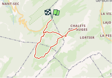
Tocht Sneeuwschoenen van 14,7 km beschikbaar op Auvergne-Rhône-Alpes, Haute-Savoie, Fillière. Deze tocht wordt voorgesteld door UDGI54.
Plaatsbepaling
Land:
France
Regio :
Auvergne-Rhône-Alpes
Departement/Provincie :
Haute-Savoie
Gemeente :
Fillière
Locatie:
Thorens-Glières
Vertrek:(Dec)
Vertrek:(UTM)
293233 ; 5093767 (32T) N.
Opmerkingen