


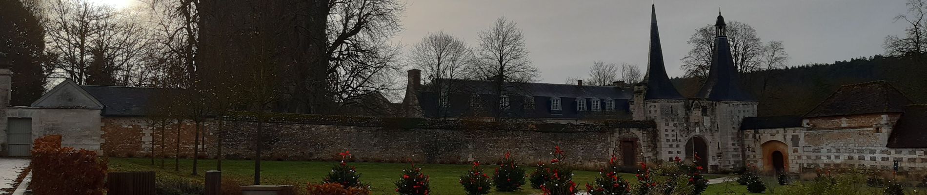
Le bec helloin

werth
Gebruiker
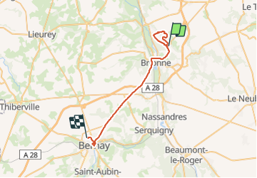

Lengte
30 km

Max. hoogte
162 m

Positief hoogteverschil
464 m
Km-Effort
36 km

Min. hoogte
48 m

Negatief hoogteverschil
368 m
Boucle
Neen
Datum van aanmaak :
2021-12-07 08:10:22.511
Laatste wijziging :
2021-12-07 11:21:23.133
2h21
Moeilijkheid : Gemakkelijk

Gratisgps-wandelapplicatie
 SityTrail
IGN / Geografische instituten
SityTrail Plus
De wereld gaat voor u open
Over ons
Tocht Stappen van 30 km beschikbaar op Normandië, Eure, Le Bec-Hellouin. Deze tocht wordt voorgesteld door werth.
Foto's


Plaatsbepaling
Land:
France
Regio :
Normandië
Departement/Provincie :
Eure
Gemeente :
Le Bec-Hellouin
Locatie:
Unknown
Vertrek:(Dec)
Vertrek:(UTM)
335703 ; 5453918 (31U) N.
Opmerkingen