


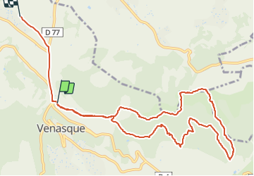
Les hauteurs de Venasque

micheldutilleul
Gebruiker

Lengte
13,2 km

Max. hoogte
417 m

Positief hoogteverschil
359 m
Km-Effort
18 km

Min. hoogte
165 m

Negatief hoogteverschil
374 m
Boucle
Neen
Datum van aanmaak :
2022-01-06 13:34:30.069
Laatste wijziging :
2022-01-06 16:43:14.519
2h45
Moeilijkheid : Medium

Gratisgps-wandelapplicatie
 SityTrail
IGN / Geografische instituten
SityTrail Plus
De wereld gaat voor u open
Over ons
Tocht Stappen van 13,2 km beschikbaar op Provence-Alpes-Côte d'Azur, Vaucluse, Venasque. Deze tocht wordt voorgesteld door micheldutilleul.
Beschrijving
Magnifique balade, mais il faut être un peu sportif.
Vue sur le mont Ventoux, passage dans la Nesque.
Plaatsbepaling
Land:
France
Regio :
Provence-Alpes-Côte d'Azur
Departement/Provincie :
Vaucluse
Gemeente :
Venasque
Locatie:
Unknown
Vertrek:(Dec)
Vertrek:(UTM)
672025 ; 4874184 (31T) N.
Opmerkingen