


Winanplanche - Cascade de Haldeboeuf

AnneCecile
Gebruiker
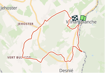

Lengte
9,3 km

Max. hoogte
430 m

Positief hoogteverschil
228 m
Km-Effort
12,3 km

Min. hoogte
255 m

Negatief hoogteverschil
228 m
Boucle
Ja
Datum van aanmaak :
2022-02-03 21:46:06.51
Laatste wijziging :
2022-02-03 21:49:00.643
3h22
Moeilijkheid : Moeilijk

Gratisgps-wandelapplicatie
 SityTrail
IGN / Geografische instituten
SityTrail Plus
De wereld gaat voor u open
Over ons
Tocht Stappen van 9,3 km beschikbaar op Wallonië, Luik, Theux. Deze tocht wordt voorgesteld door AnneCecile.
Plaatsbepaling
Land:
Belgium
Regio :
Wallonië
Departement/Provincie :
Luik
Gemeente :
Theux
Locatie:
Unknown
Vertrek:(Dec)
Vertrek:(UTM)
699967 ; 5595356 (31U) N.
Opmerkingen