


Le couvent des chèvre- version 2

crocau
Gebruiker
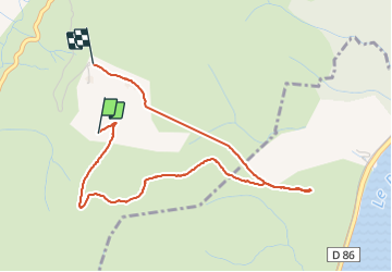

Lengte
4,2 km

Max. hoogte
392 m

Positief hoogteverschil
143 m
Km-Effort
6,1 km

Min. hoogte
279 m

Negatief hoogteverschil
136 m
Boucle
Neen
Datum van aanmaak :
2022-02-13 14:26:57.001
Laatste wijziging :
2022-02-13 16:11:21.131
1h23
Moeilijkheid : Medium

Gratisgps-wandelapplicatie
 SityTrail
IGN / Geografische instituten
SityTrail Plus
De wereld gaat voor u open
Over ons
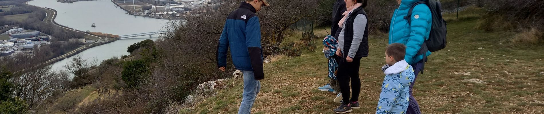
Tocht Stappen van 4,2 km beschikbaar op Auvergne-Rhône-Alpes, Ardèche, Rompon. Deze tocht wordt voorgesteld door crocau.
Foto's


Plaatsbepaling
Land:
France
Regio :
Auvergne-Rhône-Alpes
Departement/Provincie :
Ardèche
Gemeente :
Rompon
Locatie:
Unknown
Vertrek:(Dec)
Vertrek:(UTM)
637161 ; 4959019 (31T) N.
Opmerkingen