Tocht Te voet Ede - Eeskoterpad - Photo

Tous les sentiers balisés d’Europe GUIDE+

© OpenStreetMap contributors
Lengte
Lengte
9,1 km
Max. hoogte
Max. hoogte
41 m
Positief hoogteverschil
48 m
Km-Effort
Km-Effort  
9,7 km
Min. hoogte
Min. hoogte
20 m
Negatief hoogteverschil
55 m
Boucle
Boucle
Neen
Markering
Markering
Datum van aanmaak :
2022-02-14 15:28:51.324
Laatste wijziging :
2022-02-14 15:28:51.324

(0 Bericht)

Te voet
Te voet
2h12
Moeilijkheid : Gemakkelijk

Scan deze QR-code om de tocht te openen in de SityTrail-applicatie

Gratisgps-wandelapplicatie

Logo SityTrail SityTrail

IGN / Geografische instituten

SityTrail uit de App Store downloaden SityTrail uit Google Play downloaden

Logo SityTrail SityTrail Plus

De wereld gaat voor u open

SityTrail uit de App Store downloaden SityTrail uit Google Play downloaden SityTrail op Huawei AppGallery downloaden

Over ons

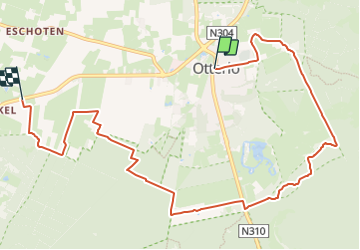
Tocht Te voet van 9,1 km beschikbaar op Gelderland, Onbekend, Ede. Deze tocht wordt voorgesteld door SityTrail - itinéraires balisés pédestres.

Hoogteprofiel

Foto's

Plaatsbepaling

Land:
Netherlands
Regio :
Gelderland
Departement/Provincie :
Onbekend
Gemeente :
Ede
Locatie:
Unknown
Vertrek:(UTM)
689841 ; 5775945 (31U) N.


Sluiten
Mijn abonnementen