Tocht Te voet Illier-et-Laramade - D'Illier à Lapège - Photo

Tous les sentiers balisés d’Europe PRO

© OpenStreetMap contributors
Lengte
Lengte
3,5 km
Max. hoogte
Max. hoogte
1015 m
Positief hoogteverschil
157 m
Km-Effort
Km-Effort  
5,3 km
Min. hoogte
Min. hoogte
891 m
Negatief hoogteverschil
62 m
Boucle
Boucle
Neen
Markering
Markering
Datum van aanmaak :
2022-02-15 18:22:11.121
Laatste wijziging :
2022-03-02 20:51:40.15

(0 Bericht)

Te voet
Te voet
1h11
Moeilijkheid : Gemakkelijk

Scan deze QR-code om de tocht te openen in de SityTrail-applicatie

Gratisgps-wandelapplicatie

Logo SityTrail SityTrail

IGN / Geografische instituten

SityTrail uit de App Store downloaden SityTrail uit Google Play downloaden

Logo SityTrail SityTrail World

De wereld gaat voor u open

SityTrail uit de App Store downloaden SityTrail uit Google Play downloaden SityTrail op Huawei AppGallery downloaden

Over ons

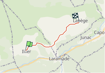
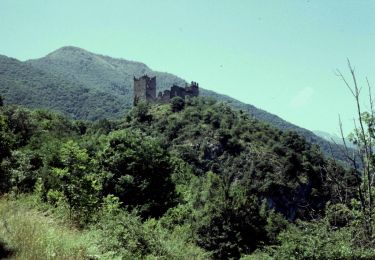
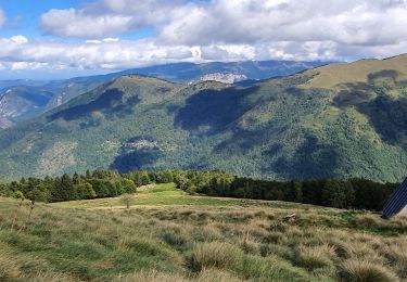
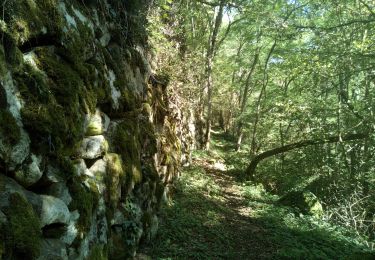
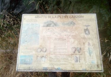
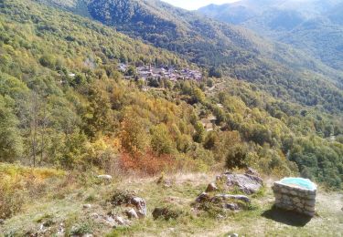
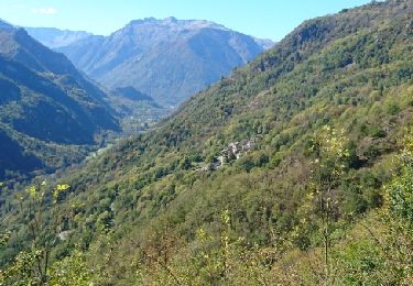
Tocht Te voet van 3,5 km beschikbaar op Occitanië, Ariège, Illier-et-Laramade. Deze tocht wordt voorgesteld door SityTrail - itinéraires balisés pédestres.

Beschrijving

Trail created by Communauté de communes de Haute-Ariège.

Foto's

Plaatsbepaling

Land:
France
Regio :
Occitanië
Departement/Provincie :
Ariège
Gemeente :
Illier-et-Laramade
Locatie:
Unknown
Vertrek:(UTM)
380565 ; 4738277 (31T) N.

Wandeltochten in de omgeving

Tocht Elektrische fiets Niaux - Niaux  - Photo
Elektrische fiets
jpborto

Elektrische fiets

Heel gemakkelijk
Niaux, Occitanië, Ariège, France
13,8 km | 21 km-effort
51min
Ja
Tocht Elektrische fiets Niaux - Château Miglos - Photo
Elektrische fiets
jpborto

Elektrische fiets

Heel gemakkelijk
Niaux, Occitanië, Ariège, France
8,1 km | 11 km-effort
45min
Neen
Tocht Te voet Lapège - Lapège et Pladetis - Photo
Te voet
PRO

Te voet

Gemakkelijk
Lapège, Occitanië, Ariège, France
10,1 km | 18,8 km-effort
4h 16min
Neen
Tocht Te voet Val-de-Sos - Le Palet de Samsom - Photo
Te voet
PRO

Te voet

Gemakkelijk
Val-de-Sos, Occitanië, Ariège, France
5,8 km | 10,3 km-effort
2h 20min
Ja
Tocht Stappen Lercoul - 2021-09-19_20h11m54_Pic-de-garbie-de-bresoul-depuis-lercoul-19x09x2021 - Photo
Stappen
chrisgps

Stappen

Medium
Lercoul, Occitanië, Ariège, France
14,7 km | 28 km-effort
6h 21min
Ja
Tocht Stappen Capoulet-et-Junac - Le Vicdessos par Illié - Photo
Stappen
c.chehere

Stappen

Medium
Capoulet-et-Junac, Occitanië, Ariège, France
14,3 km | 24 km-effort
5h 52min
Ja
Tocht Stappen Niaux - Niaux  - Photo
Stappen
c.chehere

Stappen

Gemakkelijk
Niaux, Occitanië, Ariège, France
12,2 km | 21 km-effort
3h 20min
Ja
Tocht Stappen Capoulet-et-Junac - Tour de la bouiche de Gesties - Photo
Stappen
c.chehere

Stappen

Moeilijk
Capoulet-et-Junac, Occitanië, Ariège, France
17,3 km | 0 m-effort
7h 40min
Ja
Tocht Stappen Illier-et-Laramade - 171009 EnCours - Photo
Stappen
randodan

Stappen

Heel gemakkelijk
Illier-et-Laramade, Occitanië, Ariège, France
7,9 km | 11,3 km-effort
3h 35min
Ja


Sluiten
Mijn abonnementen