


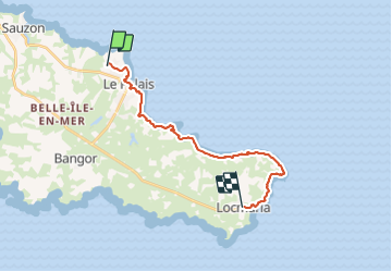
J4 - Le Palais - Locmaria - 18 km

jeanmarcMasson
Gebruiker GUIDE

Lengte
18,2 km

Max. hoogte
50 m

Positief hoogteverschil
373 m
Km-Effort
23 km

Min. hoogte
0 m

Negatief hoogteverschil
360 m
Boucle
Neen
Datum van aanmaak :
2022-03-08 10:36:31.337
Laatste wijziging :
2022-03-08 10:38:42.569
5h14
Moeilijkheid : Zeer moeilijk

Gratisgps-wandelapplicatie
 SityTrail
IGN / Geografische instituten
SityTrail Plus
De wereld gaat voor u open
Over ons
Tocht Stappen van 18,2 km beschikbaar op Bretagne, Morbihan, Le Palais. Deze tocht wordt voorgesteld door jeanmarcMasson.
Plaatsbepaling
Land:
France
Regio :
Bretagne
Departement/Provincie :
Morbihan
Gemeente :
Le Palais
Locatie:
Unknown
Vertrek:(Dec)
Vertrek:(UTM)
487289 ; 5244565 (30T) N.
Opmerkingen